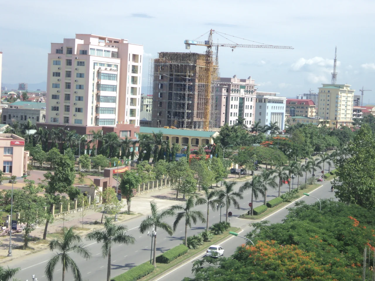

Nghệ An Province
The marker is unremarkable: a squat concrete post beside a road in Tân Kỳ, inland from the coast, surrounded by ordinary Vietnamese small-town life. It carries one number. Zero. On 19 May 1959, Hồ Chí Minh authorised a strategic supply route to the south, and this spot — then the town of Lạt — was designated its kilometre zero. Everything that went down the Ho Chi Minh Trail over the next sixteen years was measured from here. Vietnam recognised the post as a national historical monument on 27 April 1990. Nghệ An is a province that keeps producing places like this: modest ground where something enormous began.
The Road West
Geography explains a good deal of it. Nghệ An occupies the northern end of Vietnam's North Central Coast, bordered by Thanh Hóa to the north, Hà Tĩnh to the south, the Gulf of Tonkin to the east, and the Lao provinces of Xiangkhouang, Bolikhamsai and Houaphan along a long mountainous western frontier. That western edge is the point. National Route 7 climbs 225 kilometres from the coast at Diễn Châu through the hills to the Nậm Cắn border crossing, forming part of an east–west corridor that links Myanmar, Thailand and Laos to the sea at the port of Cửa Lò. Trade uses it now. Armies used it before, and the province's whole history bends around the fact that whoever holds Nghệ An holds a door between the coast and the Lao uplands.
The House at Sen Village
Ten kilometres west of Vinh, in Kim Liên commune, stand two thatched houses and a well. Nguyễn Sinh Cung was born nearby in 1890 and spent parts of his childhood at Sen village and Hoàng Trù village; the world came to know him as Hồ Chí Minh, and this cluster of buildings is now the Kim Liên Special National Relic, complete with memorial houses, temples and exhibition halls. The scale of the site sits oddly against the modesty of what it preserves — mud walls, bamboo, a low roof. Whatever a visitor makes of the man, the contrast is the exhibit. Nghệ An has never been a wealthy province, and its most famous son came out of exactly that.
1930: The Soviets of Nghệ-Tĩnh
The province had form long before 1959. In March 1930, five strikes broke out in Vinh, and the unrest spread through the countryside of Nghệ An and neighbouring Hà Tĩnh into something the colonial administration had not seen: peasants seizing local power and running their own village councils. On 12 September, a mass demonstration set out from Hưng Nguyên, three kilometres from Vinh. French aircraft dropped six bombs into the marchers, killing somewhere between 140 and 200 people and wounding hundreds. Repression followed with machine guns, mass arrests and prison camps; one estimate puts the dead at over 1,300, with roughly a thousand more lost to disease and hunger in custody. The village soviets held on in western Nghệ An until August 1931.
Truông Bồn, 31 October 1968
By the mid-1960s Nghệ An was a corridor under sustained American attack — a fuel pipeline ran southwest from Vinh, a fact U.S. analysts only pieced together in late 1968, and the roads through the province were bombed relentlessly. Keeping them open fell largely to the Thanh niên xung phong, the Youth Volunteer Force: teenagers and young adults, many of them women, who filled craters by hand between raids. At Truông Bồn, in Mỹ Sơn commune of Đô Lương, thirteen of them were killed on 31 October 1968. The American bombing campaign against the North ended two days later. The site became a national historical relic in 1996, and Vinh itself was so thoroughly destroyed that little of the old city survives; it was rebuilt with substantial East German assistance, which is why a provincial Vietnamese capital has wide boulevards and rows of concrete apartment blocks.
A Province Redrawn
Nghệ An covers 16,486.49 square kilometres and held 3,831,694 people in 2025 — for years it was Vietnam's largest province by area, a distinction it lost when the country merged 63 provinces and cities into 34 on 1 July 2025 and Lâm Đồng emerged at over 24,000 square kilometres. Nghệ An kept its boundaries but not its interior: the reform abolished Vietnam's entire district tier, so the province's old districts and towns gave way to a single level of communes and wards. Cửa Lò, absorbed into Vinh in December 2024, still runs its ten kilometres of fine sand. Inland, Thái, Khơ Mú, Thổ, Mường and H'Mông communities live in the mountains where the trail once ran, and the tea hills of Thanh Chương float like green islands on a reservoir.
From the Air
Nghệ An centres near 19.33°N, 104.83°E, running from the Gulf of Tonkin coast west to the Lao border along the Annamite Range. Vinh International (VVVH) lies on the coastal plain and is the province's only airport; Thọ Xuân (VVTX) sits just north in Thanh Hóa and Đồng Hới (VVDH) to the south, with Nội Bài (VVNB) about 300 km north at Hanoi and Xiengkhouang (VLXK) across the border in Laos. A 7,000–12,000 ft transit reads the province best: dense paddy and settlement on the eastern plain, the beach strip at Cửa Lò, then the abrupt transition to forested ridges climbing toward Laos. National Route 7 is a clear westbound thread through the mountains. Best visibility runs February to April; the September–January wet season brings low cloud over the highlands, and summer months carry haze plus the hot, dry Lào wind off the range.
Nearby Stories
- Quang Lang Air Base 11 km away
- Bến En National Park 13 km away
- Diễn Châu 29 km away
- Cửa Lò 34 km away
- Ban Nahin 85 km away
- Thanh Hóa Bridge 96 km away
- Viengxay Caves 101 km away
- Battle of Lima Site 85 152 km away