
Lake Yeak Laom
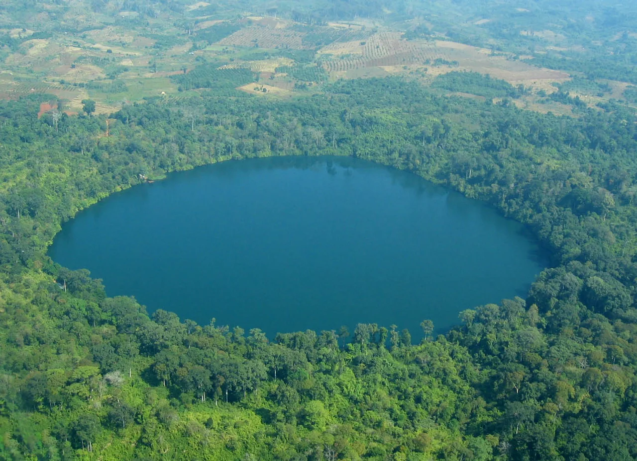
A giant dug this hole. That is the Tampuan account, and it is more specific than most origin stories: his daughter had run away with a suitor, and he tore open the earth to get her back. Rain filled the pit. The water has been there ever since. The geological account agrees about the hole and disagrees only about the digger — roughly 700,000 years ago a volcano opened in what is now Ratanakiri province in north-eastern Cambodia, and what it left behind is a crater so close to circular that it looks drawn with a compass. Eight hundred metres across, fifty metres deep, ringed by unbroken forest. Both versions arrive at the same object, five kilometres from the provincial capital at Banlung.
The Shape of an Explosion
Explosive craters tend toward roundness, but few hold the line as neatly as this one. The shoreline of Yeak Laom closes an almost perfect circle around a surface of about 0.44 square kilometres, and the walls drop steeply enough that the lake reaches fifty metres in the middle without much shelving at the edge. Nothing significant flows in and nothing flows out, which is why the water is so startlingly clear — a deep green in the middle of the day, going nearly black under the forest shadow at the rim. There are no volcanoes erupting in Cambodia now. Ratanakiri's basalt plateau is the cooled residue of a much older restlessness, and the lake is the most legible piece of evidence left.
Standing Water, Standing Forest
The forest around the rim survives because the lake is not treated as scenery. Yeak Laom and the woods that enclose it hold spiritual significance for the Tampuan, who make ritual offerings here at planting and at harvest, and when someone in a family falls ill. The Tampuan number around 31,000 and are the largest of Ratanakiri's indigenous peoples, speaking a Mon–Khmer language of the Bahnaric group — unrelated, despite the shared uplands, to the Austronesian Jarai a short distance east. Tampuan society is matrilineal and animist, organised around villages of a few hundred people, and known well beyond the province for its gong music. The lake belongs to that world first. Everything else built around it has had to fit.
Ten Elders and a Gate
By the early 1990s the pressure was showing: litter accumulating, farmland pushing at the rim. In 1995 the provincial authority and the International Development Research Centre began conservation and environmental education work alongside the Tampuan communities living around the crater, and in 1997 the communities themselves took the project over. That handover mattered. Cambodian law did not recognise indigenous community land rights until 2001, so the arrangement ran ahead of the legal framework rather than behind it. Day-to-day decisions sit with a community-based tourism committee of ten elders, one man and one woman drawn from each of five Tampuan villages, and the money taken at the gate goes back into the villages and into protecting the lake. In 2018 a sub-decree formally established the Boeng Yeak Laom Multiple Use Area, covering 36.2 hectares.
Three Kilometres Around
It is a ten-minute run from Banlung by car or tuktuk, and the entrance fee is deliberately tiered — a quarter of a dollar for Cambodians, two dollars for foreign visitors. A three-kilometre footpath circles the whole lake beneath the canopy, and wooden platforms let you drop straight into water warm enough to stay in for hours; life jackets are handed out at the edge. A small museum near the entrance sets out Tampuan culture in the villagers' own framing rather than a visitor's. Handicraft stalls sell what the surrounding villages make, along with fresh honeycomb, rice wine, dried beef and wild fruit. Come in the dry stretch from December to February for the clearest water and the easiest walking; July is the wettest month of the year, and the path turns to red mud.
From the Air
Located at 13.73°N, 107.015°E, about 5 km from Banlung in Ratanakiri province, north-eastern Cambodia. The lake is one of the most reliable visual fixes in the region — a dark, near-perfect green disc roughly 800 m across, set in continuous forest on an otherwise rolling red-earth plateau, and unmistakable from 3,000 ft upward. Terrain elevation runs around 300 m. Nearest field is Ratanakiri/Banlung (VDRK), a gravel strip with no scheduled service; Stung Treng (VDST) lies to the west and Phnom Penh International (VDPP) is the practical arrival point roughly 320 nm south-west. Best visibility December to February. From May to October the monsoon brings heavy afternoon convection over the plateau, and dry-season agricultural haze can cut slant visibility sharply in March and April.
Nearby Stories
- Đức Cơ Camp 5.4 km away
- Virachey National Park 30 km away
- Yali Falls Dam 33 km away
- Srepok River 38 km away
- Stung Treng 60 km away
- Buôn Đôn 72 km away
- Khong Island 75 km away
- Sambor Wildlife Sanctuary 117 km away