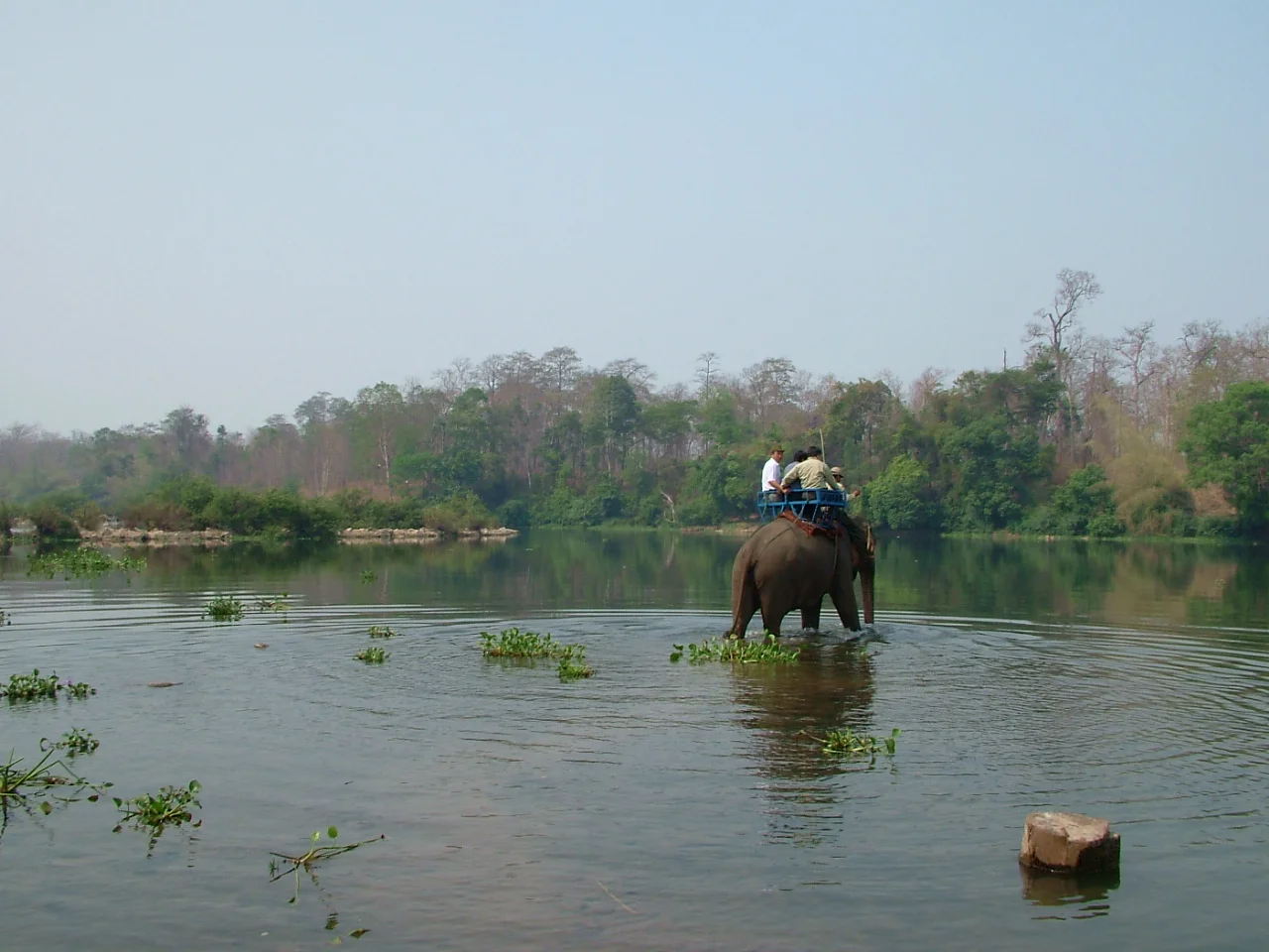

Srepok River
Two streams come down the western flank of the South Annamite mountains in Vietnam's Dak Lak province, and their local names describe a family. The Krong No is the brother river. The Krong Ana is the sister. Where the two meet, the Srepok begins - 405 kilometres of water that will cross an international border, gather two more rivers, pass through some of the last elephant forest in mainland Southeast Asia, and finish inside a reservoir. In Jarai it is Ea Srepoko. In Vietnamese it is sometimes simply Daak Krong, the big river. Almost everything interesting about it follows from one geographic accident: it flows the wrong way.
Running the Wrong Way
Most rivers in this part of the world drain east to the South China Sea. The Srepok goes the other way. From the confluence of the brother and the sister it heads west through the districts of Krong Ana, Buon Don and Ea Sup, covering about 126 kilometres before it reaches the Cambodian frontier. Just past the border it collects the Ea H'leo and the Ia Drang, then runs another 281 kilometres through Ratanakiri and Stung Treng provinces - more than two thirds of its length spent in a country it was not born in. Its final act is to join the Tonle San about 23 miles above the point where that river empties into the Mekong. Grouped with the Sekong and the Sesan, it forms the third of what water managers call the 3S rivers, the trio that supplies a large share of the lower Mekong's flow.
The Highway Before There Were Roads
In the late nineteenth century, when roads through the Central Highlands barely existed, the Srepok was the route. Lao and Khmer traders poled and paddled upstream from the Mekong to do business with the highland peoples, and Ban Don - Buon Don, in Dak Lak - grew into a busy river port on the strength of that traffic. Some of those traders stayed. Lao families settled at Ban Don and at Stung Treng at the far end of the route, and the culture of Ban Don still carries their mark, which is why a village deep in the Vietnamese highlands can feel unexpectedly Lao. The river also drew an older, quieter line: historically it separated the Western Bahnaric-speaking peoples from the South-Central Bahnaric-speaking peoples, a linguistic boundary written in water long before anyone drew a national one on top of it.
The Elephant Forest
The Srepok's Vietnamese reach runs through Yok Don National Park, established in 1986 and covering 1,155 square kilometres of deciduous and semi-evergreen forest west of Buon Ma Thuot. It abuts the Mondulkiri Protected Forest across the Cambodian border, and the two together anchor what may be the largest protected-area complex in Southeast Asia. On paper the park shelters Asian elephants, gaur, leopards and Indochinese tigers. In practice, all four have suffered severe declines, and the elephants that once made Ban Don famous as a centre of capture and mahout tradition are now a small and closely watched remnant. The forest is still there. Much of what it was meant to hold is not.
A Valley Called Ia Drang
One of the Srepok's tributaries carries a name that means something very specific to a generation of Americans and Vietnamese. The Ia Drang rises south of Pleiku, runs southwest through Chu Prong district and crosses into Ratanakiri before joining the Srepok. In November 1965 the valley it flows through was the site of the first major engagement between US Army units and regular North Vietnamese troops. Men on both sides died there in numbers that shocked their own commands, in terrain most of them had never seen before and could not have found on a map a year earlier. The river carried on doing what rivers do. Its name has been doing something else ever since.
The Wall at the Confluence
The Srepok no longer reaches its meeting with the Tonle San as a free river. The Lower Se San 2 Dam was built directly at that confluence, roughly 25 kilometres upstream of Stung Treng town, and came online in December 2018: five turbines, 400 megawatts, about 1,998 gigawatt-hours a year, at a cost near 781 million US dollars. It was developed by Cambodia's Royal Group with China's Hydrolancang International Energy and a ten percent stake held by Vietnam Electricity, and reverts to the Cambodian state after forty years. The other ledger is harder to total. Up to 2,000 people were displaced outright. At least 38,675 more, across 86 villages, were assessed as losing fishery resources they had depended on for food and income, and studies estimated that at least 78,000 people living above the dam site would lose access to migratory fish altogether. Because the Srepok and the Sesan both rise in Vietnam, everything decided here is decided across three countries at once - and settled, in the end, on the riverbank.
From the Air
The Srepok's lower course can be picked up around 13.55 degrees north, 106.28 degrees east, in Stung Treng province, northeastern Cambodia. Trace it upstream to the east-northeast and it leads across the border into Vietnam's Dak Lak province; downstream to the west it meets the Tonle San at the Lower Se San 2 Dam, whose reservoir forms a large, unmistakable impoundment about 25 kilometres east of Stung Treng town - the single easiest visual anchor on this river. Beyond the dam, the combined flow reaches the Mekong at Stung Treng, where the Sekong also arrives. Stung Treng Airport (VDST) and Ratanakiri Airport (VDRK) flank the river's Cambodian reach. Best viewed between 4,000 and 10,000 feet. Dry-season months from December to March offer the clearest water-against-forest contrast; expect heavy convection May to October and dense agricultural haze in March and April.
Nearby Stories
- Chinit River 10 km away
- Ratanakiri province 18 km away
- Prey Lang Wildlife Sanctuary 30 km away
- Sambor Wildlife Sanctuary 39 km away
- Khone Phapheng Falls 40 km away
- Virachey National Park 51 km away
- Emerald Triangle (Southeast Asia) 82 km away
- Buôn Đôn 106 km away