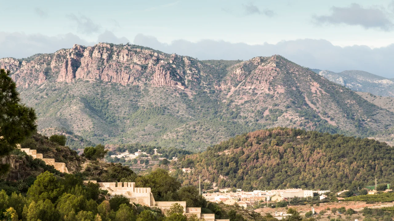

Serra Calderona
The mountains got their name from a woman on the run. In the seventeenth century, a favourite of King Philip IV whom the Spanish court remembered as "La Calderona" is said to have vanished into this range, sheltering among the highwaymen who ruled its gorges. The bandits are long gone. The name stuck. Today the Serra Calderona is a natural park of pine woods and rocky ravines less than an hour from the coast, a 49-kilometre spine of the Iberian System making its last push toward the Mediterranean - but its ridgelines still carry the memory of a place travellers once feared to cross.
The Roof of the Range
The Serra Calderona is an eastern prolongation of the Sierra de Javalambre, straddling the boundary between the provinces of Castellón and Valencia. It is not high by Spanish standards, but it rises abruptly from the plain, and from its crests the land falls away toward the sea. The summit of El Gorgo tops out at 907 metres; the Muntanya del Garbí (600 metres) and El Puntal de l'Abella (635 metres) anchor the skyline nearby. Because these are among the last foothills before the Mediterranean, a clear day rewards a climber with two horizons at once - ridge after wooded ridge inland, and the flat shine of the sea to the east.
Porta Coeli, the Gate of Heaven
Long before it was La Calderona, the range answered to a different name: the Monts de Porta Coeli, after the Carthusian monastery tucked into its folds. Porta Coeli means "Gate of Heaven," and the Carthusians who settled here belonged to one of Christianity's most austere orders - monks who lived in near-total silence, each in his own cell, meeting only for worship. A charterhouse asks for isolation, and these mountains supplied it. For centuries the monastery gave the whole range its identity, until a king's mistress and a band of outlaws quietly rewrote the map.
Bandits and Bridle Paths
The gorges that sheltered La Calderona were, for generations, genuinely dangerous. The range was a fearful place for travellers, honeycombed with caves and cut by deep river ravines, and haunted by the highwaymen known locally as roders. To cross it was to take a risk. That reputation has been thoroughly inverted. The Natural Park of the Calderona Range now protects these same slopes, and the old smugglers' country is laced with waymarked trails for hikers. The caves and gorges remain; only their reputation has softened. Where a merchant once hurried through with one eye on the rocks, a walker now stops to picnic.
Oil Worth Protecting
Across the mountainsides, olive trees grow in terraces older than anyone can date. Their fruit yields an oil so distinctive that it carries a Protected Designation of Origin - marketed, together with the parallel Serra d'Espadà just 25 kilometres north, as Aceite de las Sierras Espadán y Calderona. The Slow Food movement went further, listing it in the Ark of Taste, its international catalogue of heritage foods in danger of vanishing. It is a fitting honour for a range that has always guarded things worth keeping: silence, in the charterhouse; secrets, in the gorges; and now the peppery green oil pressed from trees that have outlasted every empire to claim these hills.
An Hour From the Coast
What makes the Calderona remarkable is not its height but its position. It rises within easy reach of Valencia and the cities of the plain, yet a few switchbacks up its flanks deliver a wholly different world - pine and cork oak, cool ravines, the scent of resin and wild herbs after rain. Villages tuck into its valleys, and hermitages dot the slopes. Weekend walkers come for the waymarked trails, cyclists for the climbs, and nearly everyone for the view from the Garbí lookout, where on a clear day the whole coastal plain unrolls toward the sea. It is a wilderness with a city at its feet, and over the centuries it has learned to be both refuge and playground at once - a range that once hid outlaws now hiding nothing but its quiet.
From the Air
The Serra Calderona runs inland northwest of Valencia, its high point near 39.73°N, 0.49°W. It reads clearly from the air as a wooded ridge system rising sharply from the coastal plain, with the Garbí summit and its viewpoint prominent above the villages of Camp de Túria. Because the terrain climbs to around 900 metres and generates its own afternoon cloud and turbulence, keep a generous margin above the ridgelines and watch for orographic weather. Valencia's LEVC lies roughly 30 km to the southeast; Alicante-Elche LEAL is far to the south. Best light and visibility come on clear mornings before thermal haze builds over the sierra.
Nearby Stories
- Desert de les Palmes Natural Park 3.5 km away
- Requena 7.9 km away
- Fosses de Paterna 8.7 km away
- Rincón de Ademuz 20 km away
- Penyagolosa 22 km away
- Festival Internacional de Benicàssim 27 km away
- Kelin 35 km away
- Hēmeroskopeion 80 km away