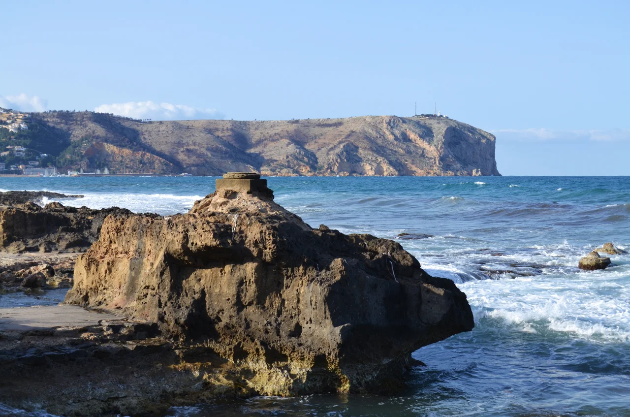

Cape Sant Antoni, Spain
From the cliffs of Cape Sant Antoni, on a clear day, you can see Ibiza, for this is the closest the Spanish mainland ever comes to the island, and the Balearics hang pale and low across the water to the east. Turn the sightline the other way and the arithmetic turns strange: from this headland a boat could run in an almost unbroken line across the entire Mediterranean, all the way to Beirut, without touching land. Cape Sant Antoni is a threshold, the place where mainland Spain leans out toward the islands and the open sea beyond.
The Nearest Shore to Ibiza
That proximity has always mattered. The cape rises just north of the town of Xabia and south of Denia, from whose harbour ferries still cross to Ibiza, following a route as old as navigation on this coast. It marks the southern edge of the Gulf of Valencia, the last flourish of that great bay before the coastline hands off to the more southerly Cap de la Nau. For sailors bound for the Balearics, Sant Antoni was the point of departure, the corner of the mainland from which you committed yourself to open water and let the shore fall away behind. The channel between the cape and Ibiza is more than a ferry lane; it hides a deep submarine trench, the cold furrow from which Denia's celebrated red prawns are hauled, so that even the seafood of this coast is tied to the line the cape draws toward the island.
The Tail of Montgo
Geologically, Cape Sant Antoni is not really its own feature at all. It is the seaward tail of the Montgo, the great massif that dominates this corner of the Costa Blanca, and the cape ends where the mountain finally plunges into the Mediterranean in cliffs 170 metres high. That connection places it within the Montgo Natural Park, and it means the headland shares the mountain's pale limestone bones and its scrubby, aromatic vegetation. From the water, the cliffs read as the abrupt full stop of a mountain that has simply run out of land.
Chapel, Tower, Lighthouse
People have watched the sea from this promontory for a very long time, and the structures on it record that habit in layers. Once there stood a small fourteenth-century chapel, a hermitage dedicated to Saint Anthony that gave the cape its name. Later came a lookout tower, part of the chain of watchposts that guarded a coast plagued by raiders. In 1855 a lighthouse was first lit here, built up from those earlier buildings, and it worked for well over a century before falling dark. Now, fittingly, it is being turned into an interpretation centre for the marine reserve, a watchtower repurposed to help people understand the water it once merely guarded against.
A Reserve Above and Below
Protection here reaches from the seabed to the cliff top. The waters off the cape form the Cape Sant Antoni Marine Reserve, sheltering the marine life of a coast famous for its clarity, while on land two plant micro-reserves guard rare species, one on the north cliff face, the other on a nearby islet. Divers come for water so clear that the bottom seems close enough to touch, and the reserve's careful rules reflect how precious such transparency has become on a crowded coast. The two micro-reserves may be tiny, but they hold plants found in few other places on earth.
Sung by Poets
The cape has earned its place in literature as well as on charts. The Mallorcan writer Baltasar Porcel evoked these waters in his 1967 travel book Arran de Mar, and long before him the Valencian novelist Vicent Blasco Ibanez set his 1895 novel Flor de Mayo against this stretch of coast. Between the poets and the prawns, the sightlines and the saints, Cape Sant Antoni has always been a place people feel compelled to describe. It is easy to see the appeal. Standing where the cliffs drop to the sea with Ibiza floating offshore, a writer, or a pilot, has the whole meeting of mainland and island laid out below.
From the Air
Cape Sant Antoni juts from the Montgo massif at 38.80 degrees north, 0.20 degrees east, between Denia and Xabia, ending in cliffs about 170 metres high with a lighthouse at the tip. From the air it is the seaward end of the bulky Montgo ridge, marking the southern edge of the Gulf of Valencia; Ibiza is often visible beyond it to the east. A coastal pass at 2,500 to 4,000 feet shows the cliffs, the lighthouse, and the marine reserve's clear water below. Alicante-Elche (LEAL) lies about 80 km southwest; Ibiza (LEIB) sits east across the strait. Best visibility is outside summer haze.
Nearby Stories
- Killing of Lasa and Zabala 6.2 km away
- Monastery of Aguas Vivas 7.3 km away
- Cocentaina 7.9 km away
- Cueva de Bolomor 37 km away
- Es Vedrà 45 km away
- Mutxamel bombing 55 km away
- Cala d'Albarca 58 km away
- Battle of Cape Cherchell 221 km away